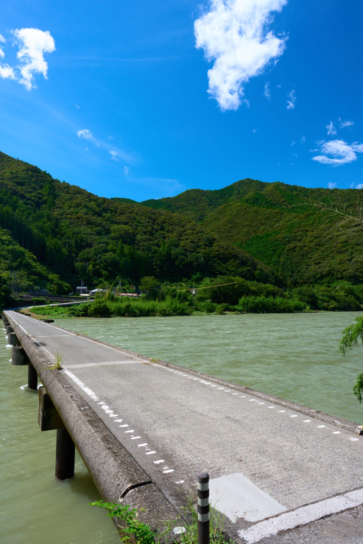
جسر ناغويا تشينكاباشي
Nagoya Submersible Bridge (Nagoya Chinkabashi), located in Ino Town, Agawa District, Kochi Prefecture, is a 191 m long, 2.5 m wide submersible bridge spanning the 124 km Niyodo River — Japan's «last clear river» — built in 1965 (Showa 40). Submersible bridges (chinkabashi) are uniquely engineered to flood with rising water rather than resist the current, preventing the bridge from being swept away; they have no railings, only a simple deck. The Niyodo carries 48 chinkabashi of various sizes; Nagoya is the most representative. Beneath it flows transparent «Niyodo Blue» water, with riverside stones and mountains on the far bank forming a scene that is the very picture of rural Japan. Locally still in active use as a road, with cars, bicycles, and pedestrians sharing the deck, it remains an unfussy daily-life landscape.
Highlights
- 191 m long with no railings — the simple form unique to submersible bridges, with functional beauty hidden in their flood-tolerant design
- Niyodo Blue — the transparent waters of Japan's «last clear river,» with emerald-green visible looking down from the bridge
- Shared with cars and bicycles — still active as a local road, with everyday life lending the frame its charm
- Four seasons from fresh greens to autumn colors — May's new growth, summer river play (July–August), October–November foliage, winter morning mist
- A network of submersible bridges — the Niyodo carries 48 chinkabashi; consider combining Sagawa, Renkon, or Ogawa Submersible Bridges